The Grampians National Park (also Gariwerd) is a national park in Victoria, Australia, 235 kilometres west of Melbourne. The Park was listed on the Australian National Heritage List on 15 December 2006 for its outstanding natural beauty and being one of the richest indigenous rock art sites in south-eastern Australia.
The Grampians feature a striking series of sandstone mountain ranges. The ranges were named in 1836 by Surveyor General of New South Wales Sir Thomas Mitchell after the Grampian Mountains in his native Scotland, but are also known by the name Gariwerd, from one of the local Australian Aboriginal languages, either the Jardwadjali or Djab Wurrung language. After a two-year consultation process, the park was renamed Grampians (Gariwerd) National Park in 1991, however this controversial formality was reversed after a change of state government in 1992. The Geographic Place Names Act 1998 reinstated dual naming for geographical features, and this has been subsequently adopted in the Park based on Jardwadjali and Djab Wurrung names for rock art sites and landscape features with the National Heritage List referring to Grampians National Park (Gariwerd).
This area is a distinct physiographic section of the larger Western Victorian Highlands province, which in turn is part of the larger East Australian Cordillera physiographic division.
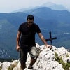
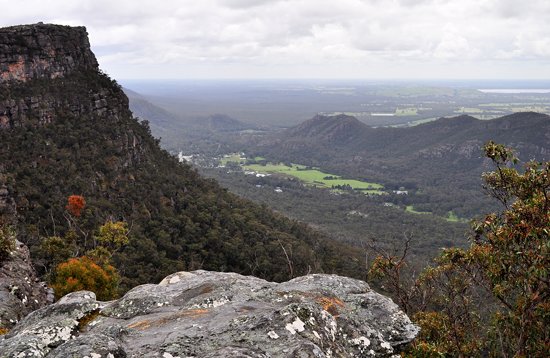
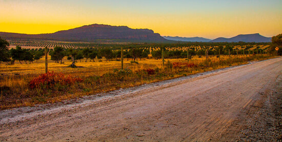
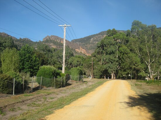
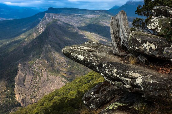
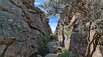
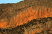
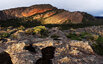
The general form that the ranges take is, from the west, a series of low-angled sandstone ridges running roughly north-south. The eastern sides of the ridges, where the sedimentary layers have faulted, are steep and spectacular, beyond the vertical in places - notably at Hollow Mountain near Dadswell's Bridge at the northern end of the ranges. The most popular walking area for day trippers is the Wonderland area near Halls Gap. In summer the ranges can get very hot and dry. Winter and spring are the best times for walking. The Wonderland area is also host to "The Grand Canyon" on the "Wonderland Loop" on one of the tracks to the "Pinnacle".
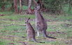
In spring the Grampians wildflowers are a major attraction. The area is a noted rock climbing destination, and it is popular with campers and bushwalkers for its many spectacular views and unspoilt nature.
Mount William is known within the gliding community as the epicentre of the 'Grampians Wave', a weather phenomenon enabling glider pilots to reach extreme altitudes above Шаблон:Convert. This predominantly occurs during the months of May, June, September and October when strong westerly winds flow at right angles to the ridge, and produce a large-scale standing wave (Mountain Lee Wave).
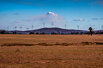
The rock material that composes the high peaks is sandstone which was laid down from rivers during the Devonian era 380 million years ago. This sediment slowly accumulated to a depth of 7 km; this was later raised and tilted for its present form. Forty million years ago the Southern Ocean reached the base of the northern and western base of the mountain range, the deposition from the range forming the sea floor which is now Little Desert National Park.
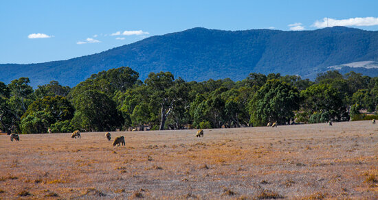
The highest peak is Mount William at 1167 metres. Numerous waterfalls are found in the park and are easily accessible via a well-developed road network.
To the Jardwadjali and Djab wurrung peoples Gariwerd was central to the dreaming of the creator, Bunjil, and buledji Brambimbula, the two brothers Bram, who were responsible for the creation and naming of many landscape features in western Victoria.
Grampians National Park (Gariwerd) is one of the richest Indigenous rock art sites in south-eastern Australia and was listed on the National Heritage for its natural beauty and its past and continuing aboriginal cultural associations. Motifs painted in numerous caves include depictions of humans, human hands, animal tracks and birds. Notable rock art sites include:
The rock art was created by Jardwadjali and Djab Wurrung peoples, and while Aboriginal communities continue to pass on knowledge and cultural traditions, much indigenous knowledge has also been lost since European settlement of the area from 1840. The significance of the right hand prints at Gulgurn Manja is now unknown.
Dual naming of features has been adopted in the Park based on Jardwadjali and Djab Wurrung names for rock art sites and landscape features, including:
Halls Gap / Budja Budja is the largest service town in the area and is located at a point roughly equidistant between the towns of Ararat and Stawell. The town is located towards the eastern side of the park and offers accommodation to the many tourists who visit the area.
The Brambuk National Park and Cultural Centre in Halls Gap is owned and managed by Jardwadjali and Djab Wurrung people from five Aboriginal communities with historic links to the Gariwerd-Grampians ranges and the surrounding plains.
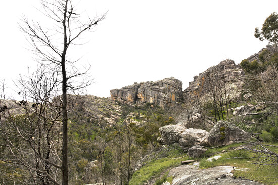
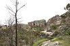
A major bushfire burned out about 50% of the Grampians National Park in January 2006. Soon afterwards the first signs of regeneration were already visible with, for example, regrowth of the eucalyptus trees. Many trees exhibit epicormic growth, where a mass of young shoots re-sprout along the whole length of the trunk to the base of the tree. Major flooding followed 5 years later in January 2011, forcing the closure of some parts of the Grampians National Park for several months. An earthquake with a magnitude of 3.8 followed six months later, although this did not cause any damage.