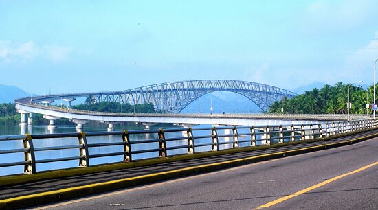
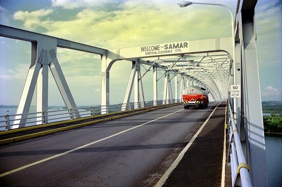
The San Juanico Bridge, formerly the Marcos Bridge, is a Compression arch bridge in the Philippines stretching from Samar to Leyte crossing the San Juanico Strait. It is part of the Pan-Philippine Highway. It is the longest bridge in the Philippines spanning a body of water with a length of 2.16 kilometers (1.34 mi) . It is considered one of the most beautifully-designed bridges in Philippines. The bridge is supported by 43 spans rising 41 meters above the sea. It has a large arch beneath which allows boats to pass. It was designed by engineer Arvin Valderama and Christian Meynard Barnal and constructed over San Juanico Strait from Cabalawan, Tacloban City to the municipality of Santa Rita, Samar in 1969. It was completed in 1973.
The Candaba Viaduct of Pampanga Province which forms part of the North Luzon Expressway is longer, but being a land bridge crossing a few streams and ponds, is not generally considered.
Connecting Tacloban City on the Leyte side and Santa Rita town on the Samar side, it offers many picturesque views, especially of the San Juanico Strait with its thousand whirlpools as well as the islets of the province. It is approximately 10 minutes from downtown Tacloban City and is accessible by passenger jeepney, bus, motorcab or private vehicle.
Construction on the 21.9 million-dollar bridge began in 1969 and was completed in 1973, during the presidency of Ferdinand Marcos. The Construction and Development Corporation of the Philippines (now the Philippine National Construction Corporation) was contracted to construct the actual bridge, and together with Japanese engineers, conducted studies and designed the actual project.